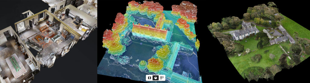
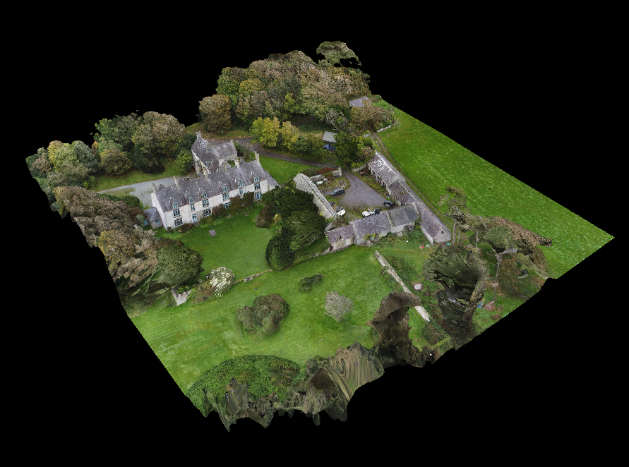
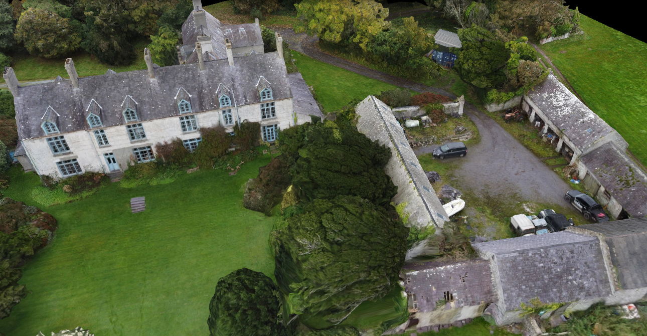
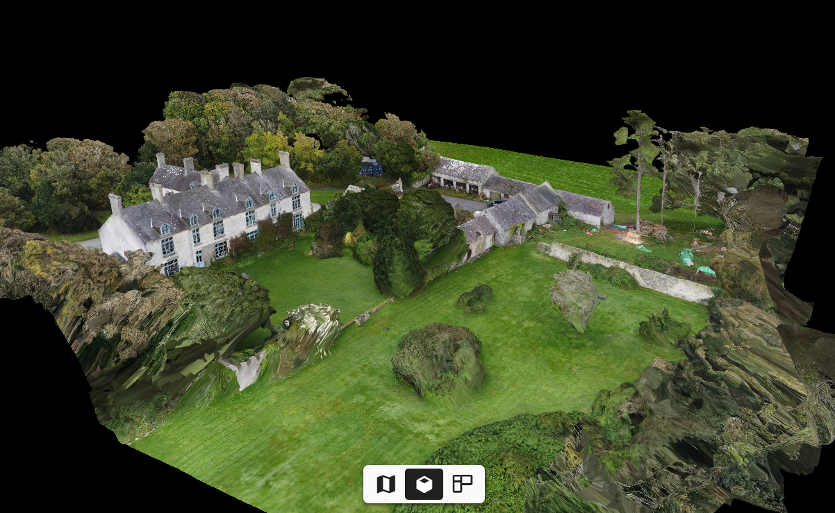
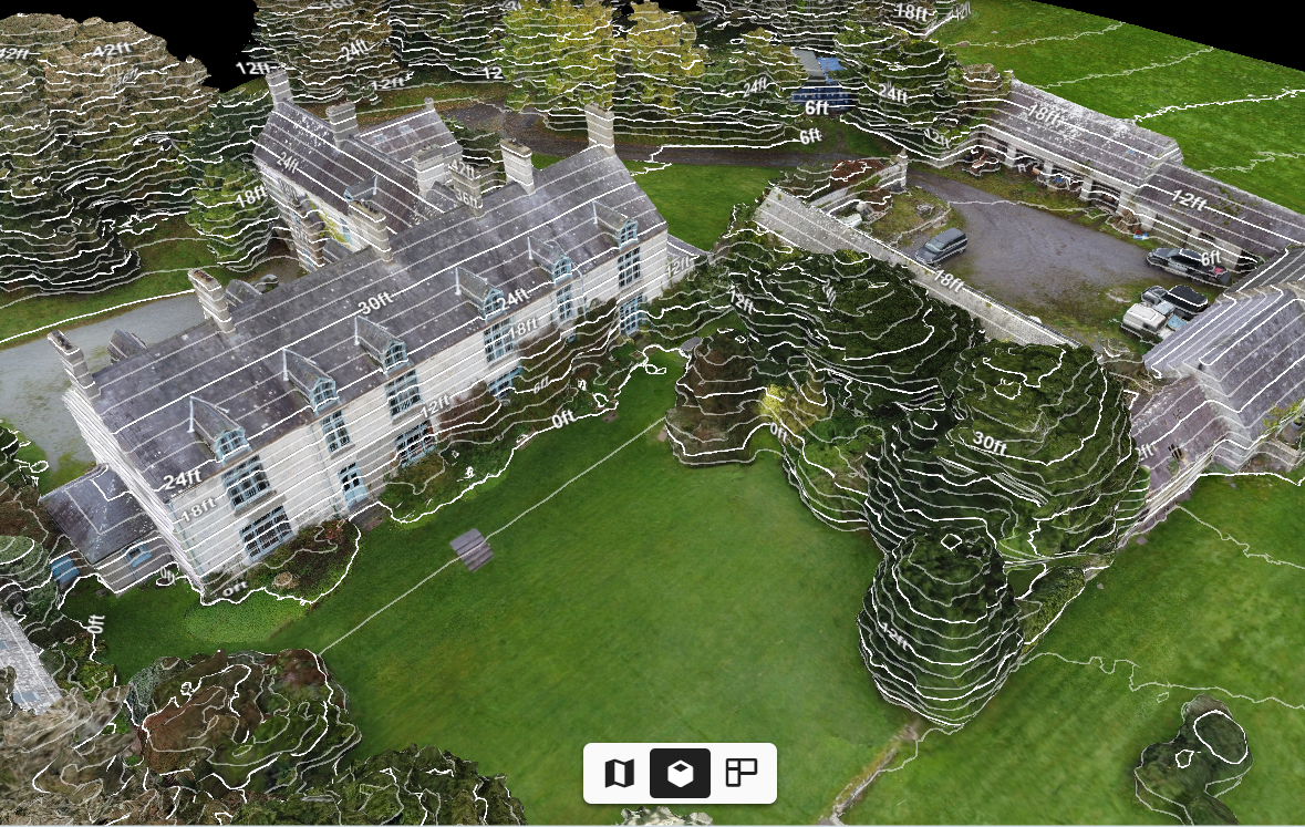
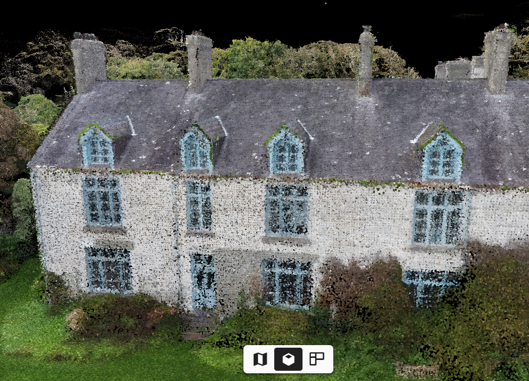
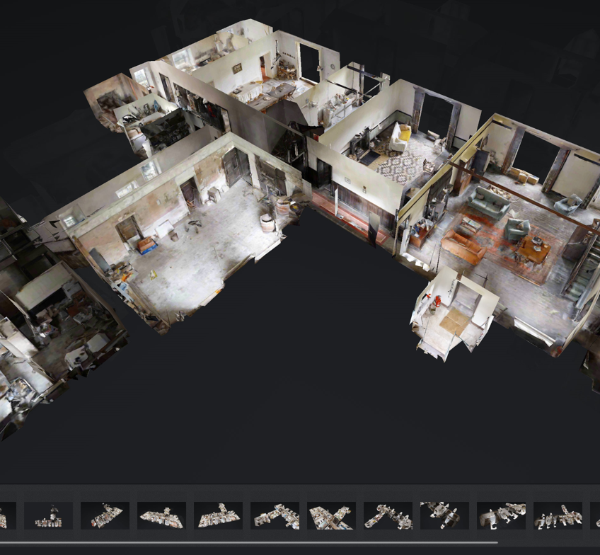
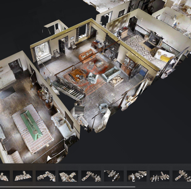
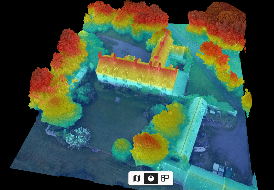
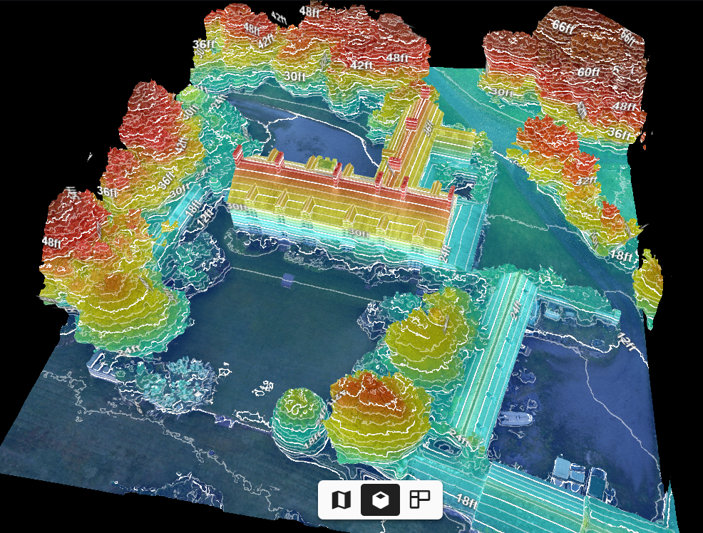
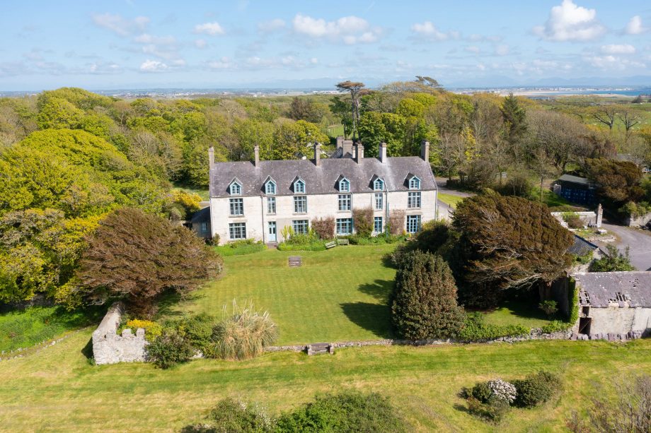
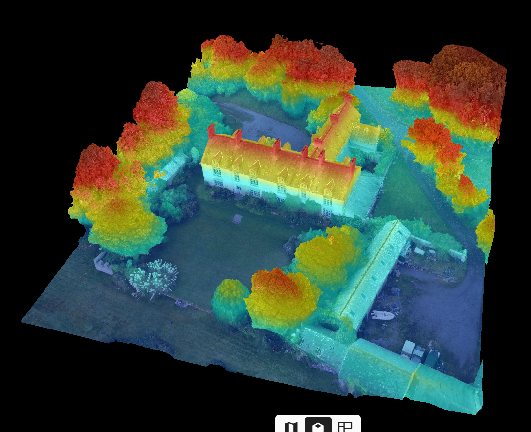
It never ceases to amaze me how fast technology is advancing. Here’s an example of what can be done very quickly and cheaply these days, that would have taken a very long time to do manually only a few years ago. 3D mapping for architects, engineers and construction creates a 3D digital model of both inside & outside a building. These 3D models can then be imported into CAD software allowing the work-flow to be speeded up massively. The following 3D modelling example is from 360 Virtual View (Based in Sheffield, UK)
3D mapping for architecture, construction, and engineering (ACE) is the process of creating a digital three-dimensional representation of a physical object or environment. This can be done using a variety of technologies, including laser scanning, photogrammetry, and drone mapping.
3D mapping has a wide range of applications in ACE, including:
- Design: Architects and engineers can use 3D models to visualize their designs and make changes before construction begins. This can help to reduce errors and improve the overall quality of the project.
- Construction: 3D models can be used to guide construction workers and ensure that the project is built according to the design. This can help to improve efficiency and reduce costs.
- Inspection: 3D models can be used to inspect buildings and other structures for defects or damage. This can help to identify potential problems early on and prevent costly repairs later on.
- Maintenance: 3D models can be used to create maintenance plans and track the condition of buildings and other structures over time. This can help to extend the lifespan of these assets and reduce overall costs.
Examples of how 3D imaging and mapping are being used
Here are some specific examples of how 3D mapping is being used in ACE today:
- Architects are using 3D models to create virtual tours of their designs, which allows clients to see their new homes or businesses before they are built.
- Engineers are using 3D models to analyze the structural integrity of bridges and other structures.
- Construction companies are using 3D models to plan and coordinate their work, and to track progress on projects.
- Facility managers are using 3D models to create maintenance plans and track the condition of their buildings and other assets.
3D mapping is a rapidly evolving technology, and new applications are being developed all the time. As the technology becomes more affordable and accessible, it is likely to play an even greater role in ACE in the years to come.
Benefits of digital 3D mapping and imaging
Here are some of the benefits of using 3D mapping in ACE:
- Improved accuracy and efficiency: 3D models can be used to create highly accurate and detailed representations of buildings and other structures. This can help to improve the accuracy of construction projects and reduce the risk of errors.
- Reduced costs: 3D mapping can help to reduce costs in a number of ways. For example, it can help to reduce the need for manual surveys and inspections. It can also help to identify potential problems early on, which can prevent costly repairs later on.
- Improved communication and collaboration: 3D models can be used to improve communication and collaboration between different stakeholders in a project. For example, architects, engineers, and contractors can use 3D models to share their ideas and coordinate their work.
- Increased safety: 3D models can be used to identify potential safety hazards in construction projects and to develop safety plans. For example, 3D models can be used to identify areas where workers may be at risk of falling or being struck by objects.
Overall, 3D mapping is a powerful tool that can be used to improve the accuracy, efficiency, cost-effectiveness, safety, and communication in ACE projects.

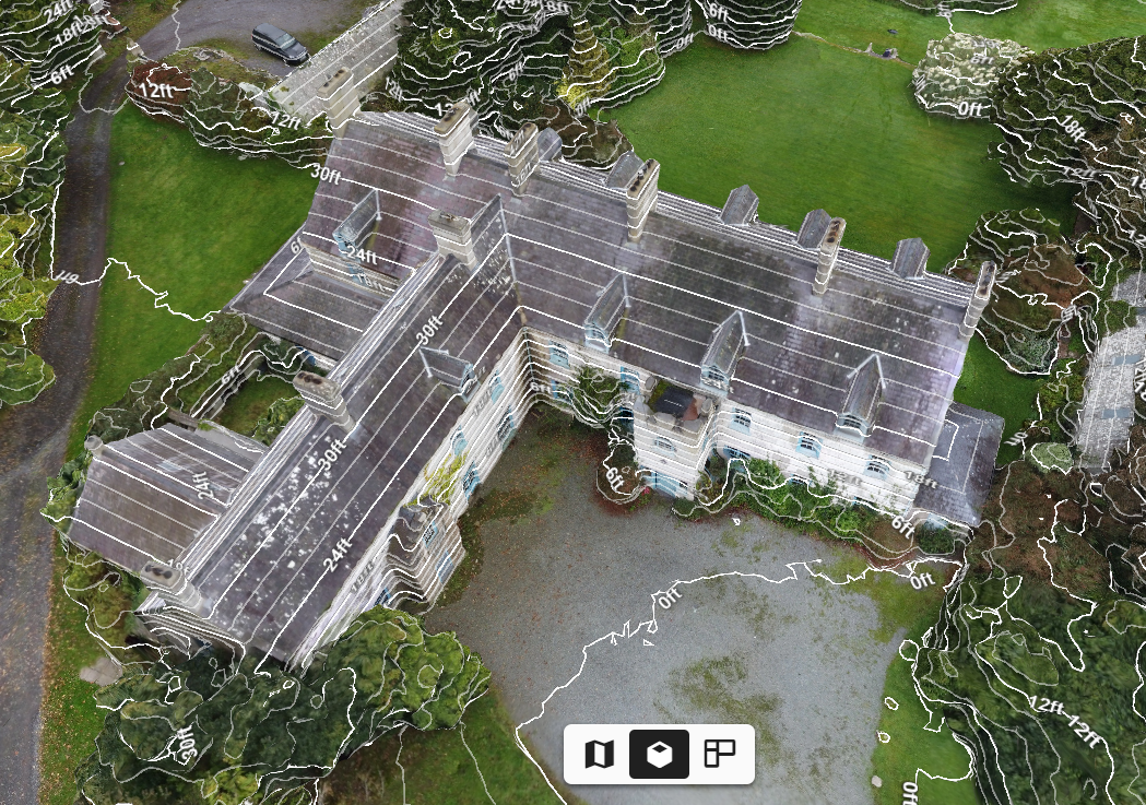
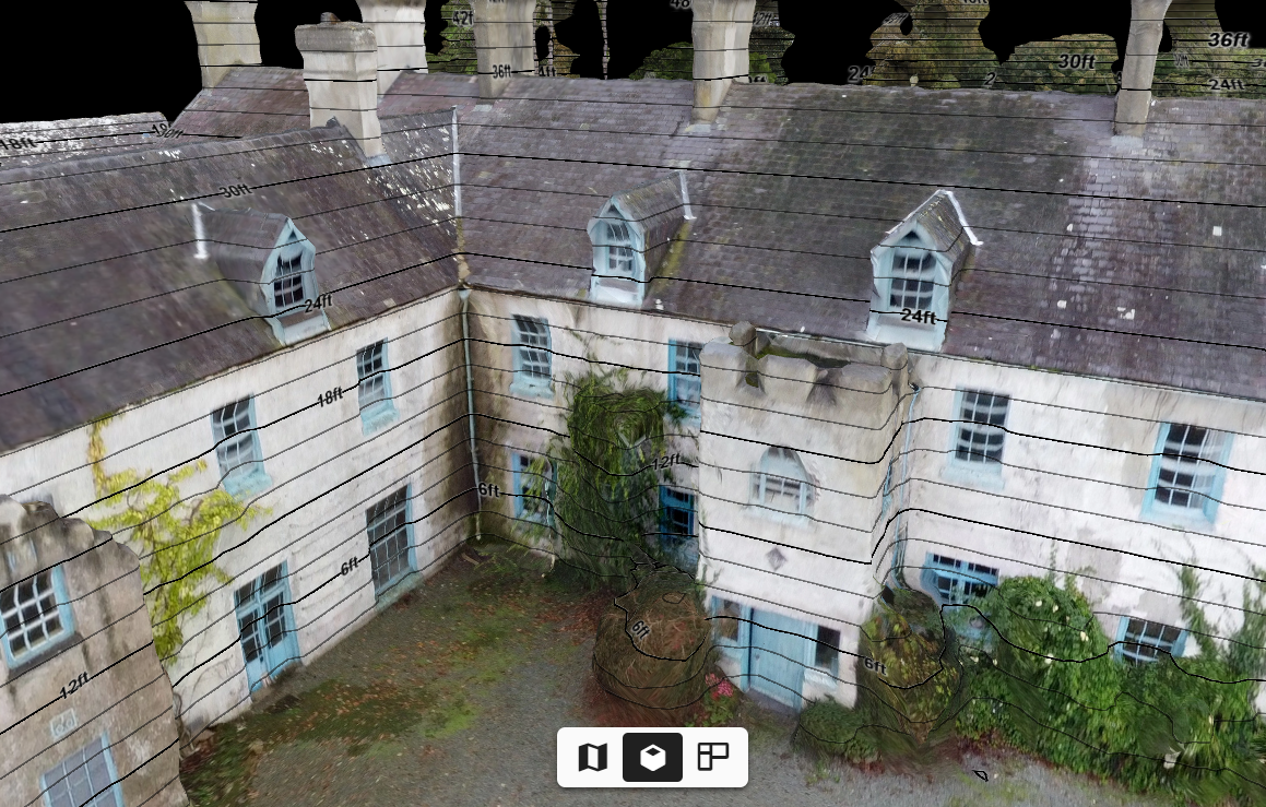
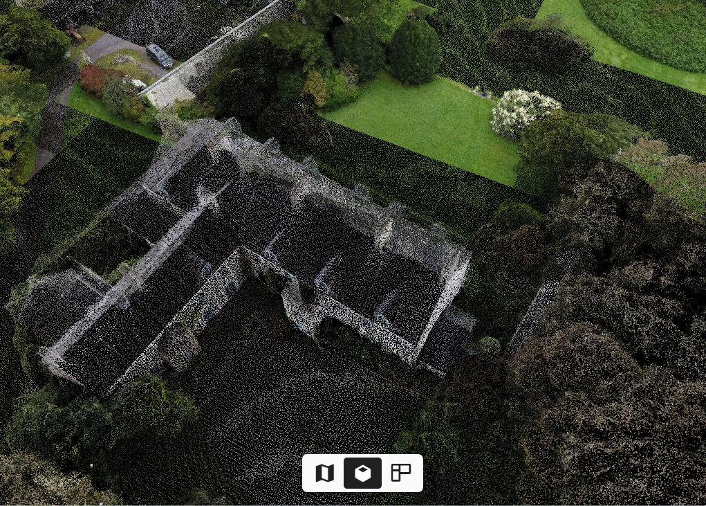
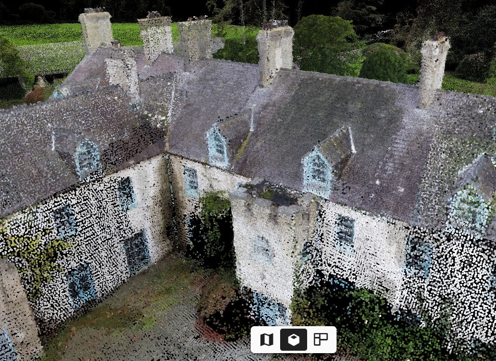
Many different files types and options
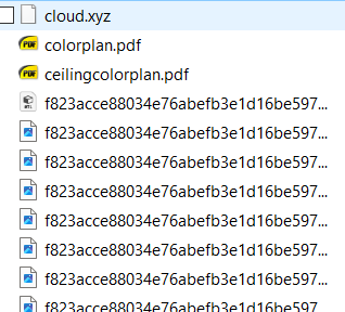
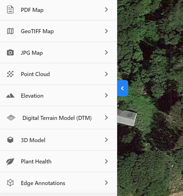
The example shown on this page produced many files including the following:
- .E57 file
- TruPlan (.SKX file) for Xactimate
- BIM file (LOD 200 building information model in .RVT and .DWG format)
- .IFC (platform neutral) & .RCS (ReCap point cloud) files
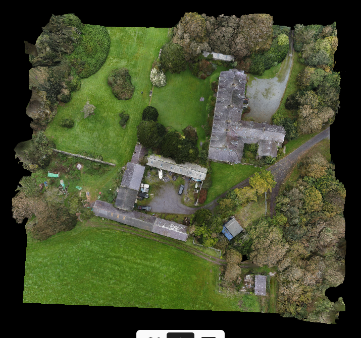
- GeoTIFF map
- JPG map
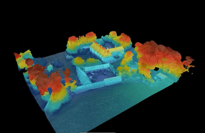
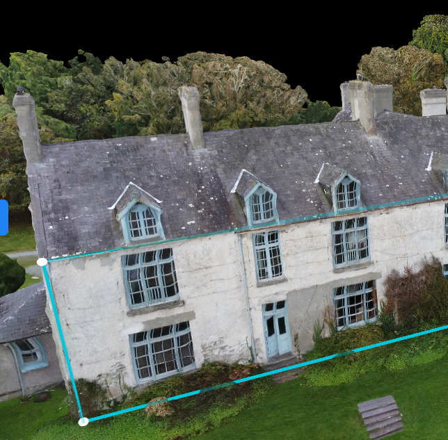
- External and internal point cloud
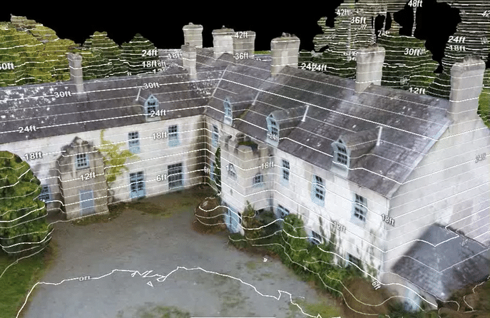
- Elevation
- Digital Terrain Model (DTM)
- 3D model
- Ceiling colour plan
- Colour plan
- .OBJ & .MTL files
- .YYZ Cloud file
- Edge annotations (External)
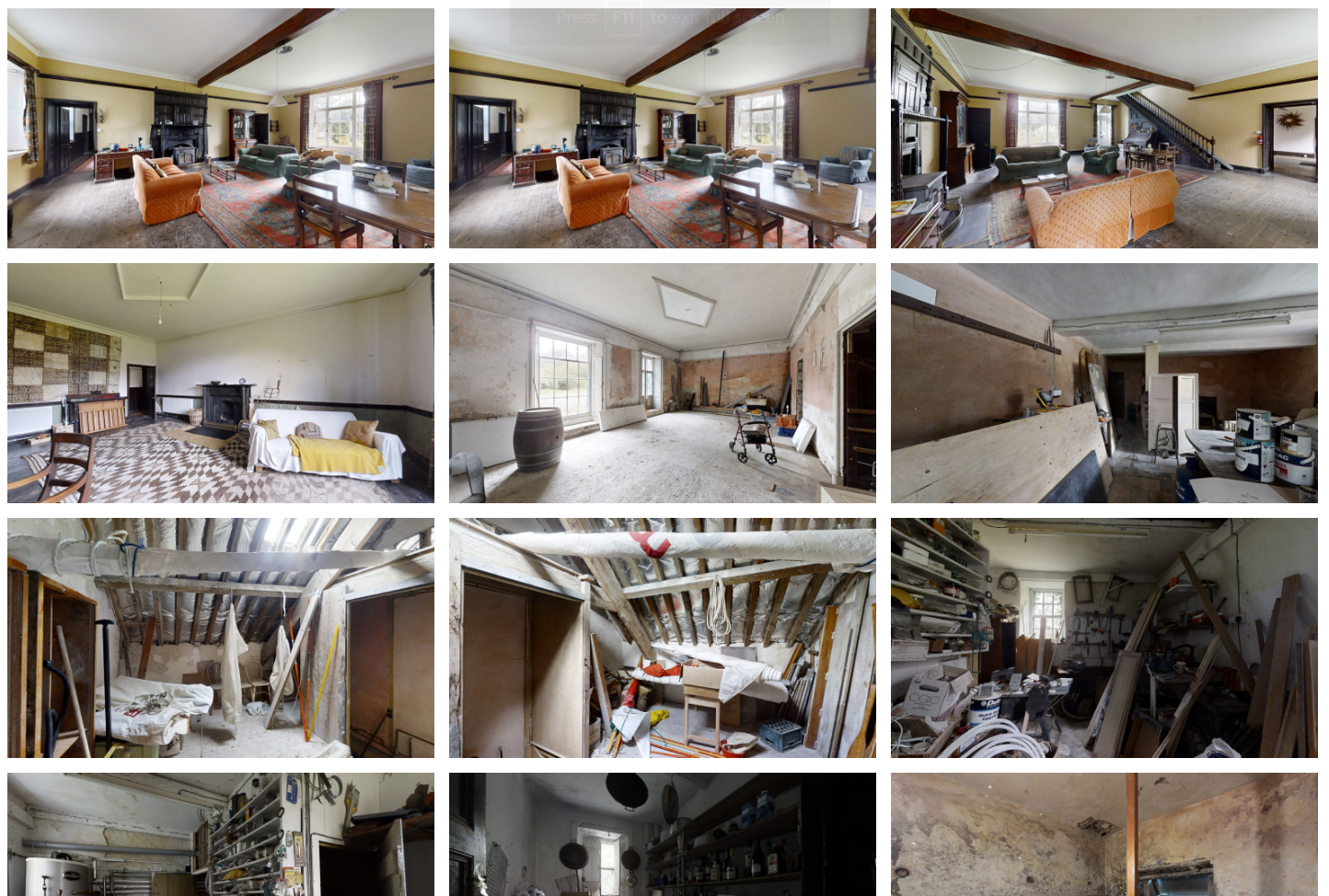
- Film (4kHD) and photographic roof survey
- Full HDR virtual tour – accessible via desktop, mobile and VR (Oculus VR)
- Interactive internal 3D model
- HDR images & internal 3D views
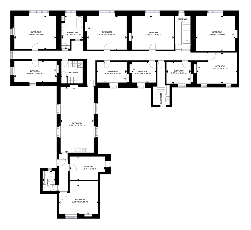
- Schematic floor plan
3D mapping enquiry
For more information or to find a 3D mapping company, contact 360 Virtual View